RRWCD boundary to change
House Bill 19-1029 passed the Colorado Legislature and was signed into law by Gov. Jared Polis April 16. It will become effective Aug. 2. The bill will modify the boundary of the Republican River Water Conservation District.
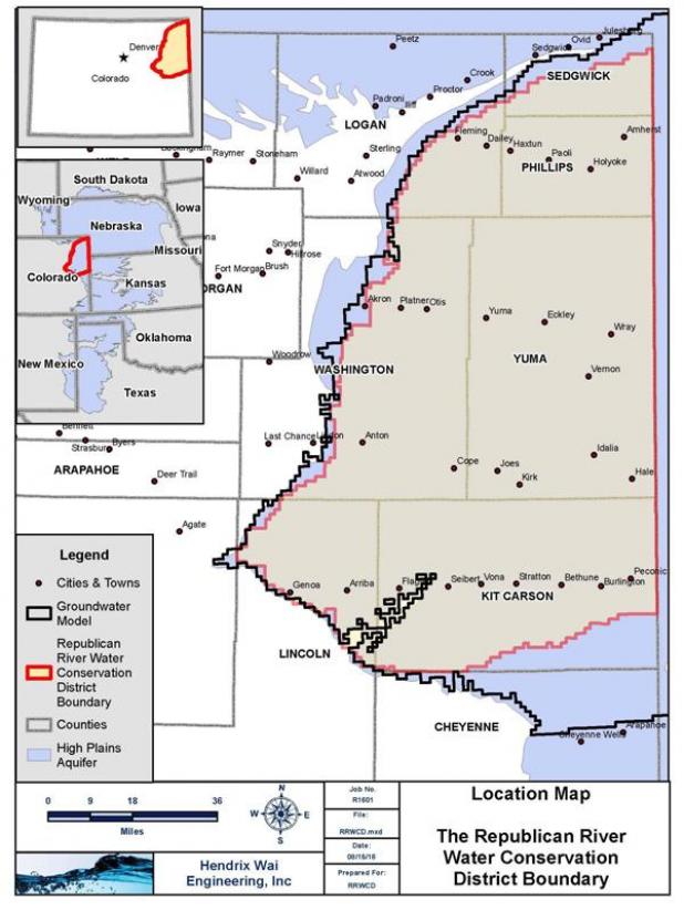
On Sept. 17, 2003, Special Master Vincent McKusick signed the Final Report of the Special Master with the adoption of RRCA Groundwater Model, which included a map of the Republican River Groundwater Model Domain.
On Aug. 4, 2004, Senate Bill 04-235 created the RRWCD to assist Colorado in complying with the Republican River Compact, which was signed in 1942. The compact between Kansas, Colorado and Nebraska apportioned the waters of the Republican River Basin among the three states.
The boundary of the RRWCD was set by SB04-235 using the topographic boundary of the basin. The original RRWCD boundary did not match the boundary of the Republican River Groundwater Model Domain, which includes all land in the High Plains Aquifer that was in hydrologic connection with the Republican River.
The full article is available in our e-Edition. Click here to subscribe.